Unleashing the Power of Tech: How We Study and Predict Volcanic Eruptions
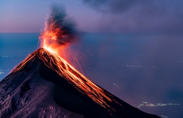
Volcanoes have been a subject of fascination for humans for centuries. They are among the most powerful natural phenomena on Earth and have the potential to cause catastrophic damage to the surrounding areas. However, advances in technology have enabled us to study volcanoes and their behaviour in unprecedented detail. In this blog post, we will explore some of the technologies that are being used to monitor and study volcanoes.
Ground-Based Monitoring Technologies
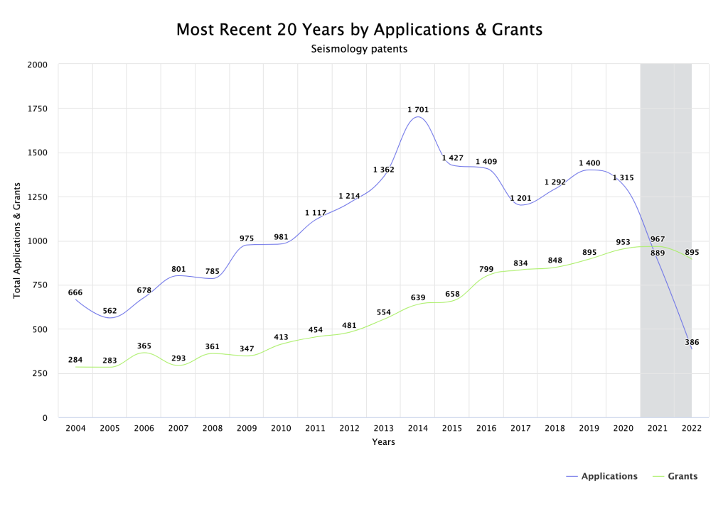
Ground-based monitoring technologies are some of the most common methods for studying volcanoes. One such technology is seismology, which involves the use of sensitive instruments called seismometers to detect and measure vibrations in the ground caused by volcanic activity. Seismometers are placed around the volcano to record the frequency, amplitude, and duration of these vibrations. By analysing this data, scientists can determine the location and intensity of volcanic activity.
Another ground-based technology is tiltmeters, which measure changes in the angle of the ground caused by swelling or deflation of the volcano. These changes in angle can be a sign of increased volcanic activity and monitoring them can provide important insights into the behaviour of a volcano.

Airborne Monitoring Technologies
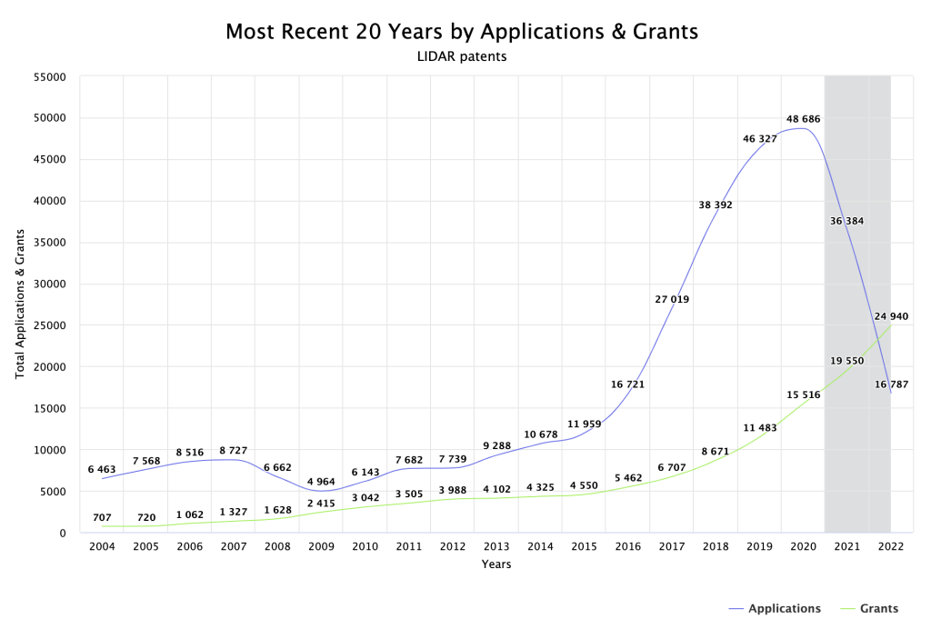
In addition to ground-based monitoring, airborne technologies are also used to study volcanoes. One such technology is LIDAR (Light Detection and Ranging), which uses lasers to create 3D maps of the volcano and its surroundings. LIDAR can provide detailed information about the topography of the volcano, as well as the distribution of ash and other volcanic materials in the air.

Another airborne technology is satellite remote sensing, which involves the use of satellites to monitor the surface of the Earth. Satellites can detect changes in the temperature of the volcano, as well as changes in the amount of sulphur dioxide and other gases being emitted. By analysing this data, scientists can gain insights into the behaviour of the volcano and its potential to erupt.
In conclusion, the technologies used to study and monitor volcanoes have advanced significantly in recent years. Ground-based monitoring technologies such as seismology and tiltmeters provide important data about the behaviour of the volcano, while airborne technologies such as LIDAR and satellite remote sensing provide a more comprehensive view of the volcano and its surroundings. By combining these different technologies, scientists can gain a better understanding of the complex processes that occur within volcanoes and make more accurate predictions about their behaviour. As technology continues to advance, we can expect even more sophisticated methods for studying and monitoring volcanoes in the future.
The graphs in this article were created in PatBase, the industry-leading online patent database. Patents can help to identify new areas of innovation, licensing, and partnership opportunities, and shed light on competitors’ R&D activity. Minesoft’s suite of global patent information solutions support IP and R&D teams, helping them to harness the power of patent data and make informed business-critical decisions. Request your free trial of PatBase here.

